 |
| Lake Osborne - ancient trees border an ancient lake |
Contrary to my last post, I went bushwalking again with my
friend yesterday and in contrast to several previous trips to the Huon Valley,
the weather remained delightful the entire time. Nor did we see a single
snake. Sometimes you can have too much nature.
Our first mission in the Hartz Mountains National Park,
was the gentle 45 minute walk to Lake Osborne. It was still a bit overcast as we set off, but mercifully not cold or windy, which is more often the case in these parts. The valley through which we walk shows many
signs of past glaciation to which Tasmania was subject not once, but many times.
You can see the sharply defined peaks and carved valleys – it is not for
nothing that the range to our left is called the Devil’s Backbone.
Then there are the “sheep rocks” – the roches
moutannees formed when the thick layer of slow moving ice scoured their leading
edges smooth and then fractured the rock on the southern side into irregular
shapes as the powerful wedge of compressed ice passed over them. Although you see
these in other parts of the state, I have rarely seen such large ones as here.
There are also "erractics" -large rocks carried by the glacier for a time and then dropped in some random location far removed from their source. Lastly, there are also the uneven rubble fields or “moraines”
left behind on the valley floor as the glaciers gradually retreated leaving
their load of pushed up dirt and stones behind. It is such a wall of stones that
dams the lake created as the glaciers retreated during a warming phase.
 |
| "Sheep Rocks" on the hills and carved valley sides attest to glacial forces |
 |
| The biggest sheep rocks I have seen - at first I took them to be "erratics." |
The clouds clear as we reach the lake. We should have brought sun block instead of raincoats or preferably both as the UV is intense. As we sit silently by the lake – it looks too icy to jump
in, it becomes apparent how ancient this vegetation is.
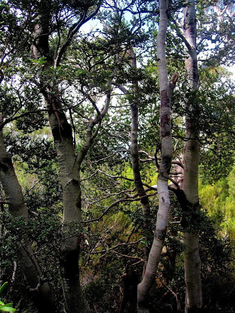
The few tortured King Billy pines which remain here are most likely very old - they can reach 1700, possibly 2000 years of age. They are among several endemic conifers such as the Huon Pine,
the Celery Top and the Pencil Pine which date from Gondwana times 125 million
years ago, before the continents split off and went their separate ways.
Once
this type of vegetation covered much of Australia and Antarctica, but as the continents
drifted northwards and grew warmer, Tasmania especially the southern, central
and western forests, became their last refuge. The fact that variations also exist in South America, Africa and New Zealand, supports the idea that the continents were once joined while the degree of divergence reflects growing
speciation as the resulting land masses became more isolated.
 |
| The stillness of the lake belies the violent forces of nature which created it |
Unfortunately only a few dozen
specimens of King Billy Pine are left in this area as they are slow growing and
easily destroyed by fire which not only causes the trees to perish, but their
seeds as well. It is estimated that 30%
of King Billy Pines have already been lost due to fire - by prospectors,
forestry burns and campers, and by wildfires resulting from lightning strikes, but now they are also increasingly threatened by
climate change.
Tree ring studies of the King Billy Pine have already been used to chart climate change and precipitation going back 1700 years. Now Climate Change Org. wants us to
report their location and condition to help to chart the effects of climate
change and predict their future distribution.
 |
| Branchlets, leaves and fruit of the King Billy Pine |
There is another thing I love about this
landscape though. It’s the Japanese garden effect. The post glacial soils are shallow
but rich and that combined with the cold climate which usually prevails here,
creates charming bonsai effects with densely covered but low growing plants
which collectively protect each other from the wind.
The bright red Waratah is in bud but not yet in bloom, but its place on the red scale is being held by Richea Scoparia, a prickly heath plant which I have so far only seen on a difficult alpine trek into the Walls of Jerusalem National Park. This type of subalpine vegetation is only found
above 600 metres and occurs in only about 5% of Tasmania. Unfortunately, it too is very vulnerable to
being “loved to death” by humans.This is why much of this walk is protected by
duckboards and you are asked not to stray from the track.
While we may mourn the loss of “pure
wilderness” and having to use fuel stoves instead of campfires, we are lucky to
be able to see this vegetation at all and much credit should go to Parks and
Wildlife for enabling us to do so with minimal impact. The duckboards are much easier to walk on too than old fashioned cording or the rough terrain usually found in moorland
 |
| Dense low growing shrubs are characteristic of the subalpine landcsape |
 |
| Close -up of Richea Scoparia - a prickly heath plant which generally comes in a range of colours |
 |
| Not sure what this is - it could be a dwarf leatherwood, but note the compact habit and the many trunks |
 |
| More sheltered spots or those with deeper soils allow for dense low growing myrtles with many trunks... |

Comments